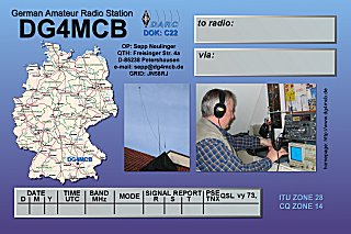
German Amateur Radio Station
DG4MCB
OP: Sepp

Locator: JN58RJ -
11*
28' 37'' E / 48* 24' 16'' N (WGS84)
465m above
sealevel
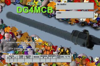
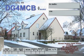
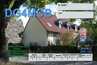
my QSL cards
German Amateur Radio Station
DG4MCB
OP: Sepp
Locator: JN58RJ -
11*
28' 37'' E / 48* 24' 16'' N (WGS84)
465m above
sealevel
my QSL cards
 |
 |
 |
 |
 |
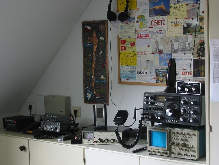
HF-RX/TX:
Sommerkamp FT-901DM
160 - 80 - 40 - 20 -
15 - 10m SSB
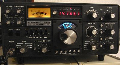
15m / 20m dualband
wire
dipole antenna, direction: 50 / 30 degrees
40m monoband wire
dipole
antenna, direction: 155 degrees
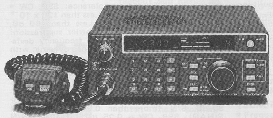
frequ: 144 ... 146
MHz
430 ... 440 MHz
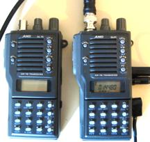
RX/TX: Alinco DJ 560,
FM (2W / 0,2W)
Packet Radio / APRS:
soundcard modem
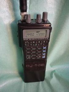
RX/TX: Alinco DJ-F1E,
FM (5W / 1W / 0,2W) Freq: 144 ... 146 MHz
RX/TX: Alinco DJ-F4E,
FM (5W / 1W / 0,2W) Freq: 430 ... 440 MHz
VHF standby frequency: 145.600 via DB0XF
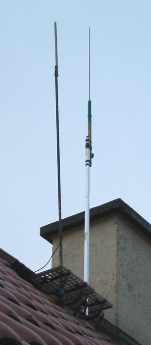
abt. 11 m above ground |
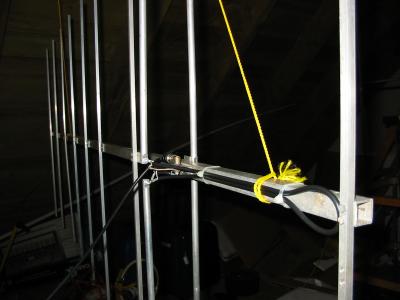
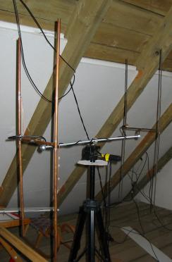 coupled HB9CV antennas for 145 MHz
|
VHF / UHF antennas
|
|
|
|
| QTH Locator V0.50 is a 32bit
Windows
(WIN95 .. XT) program to calculate distances and angles between 2
stations,
with a data base to handle and store position data (even usable as a
simple
logbook) and a lot of graphic stuff to display geographic positions. It
is capable to display self-made maps or UIVIEW maps also. Version 0.50
supports english, spanish and german language. It's a non commercial
"just
for fun" program, free of charge, but also without any guarantee and
support.
To use at your own risk only. Please read the terms
of use first.
Easy to use transformation of positions from / into Maidenhead Locator, latitude and longitude in decimal, DMS, DMH, Gauss-Krüger and UTM format. |
QHT Locator V0.50 ist ein 32
Bit Windows
(WIN95 .. XT) Programm zur Berechnung von Entfernung und Richtung
zwischen
2 Stationen. Das Programm verfügt über eine Datenbank (sogar
als einfaches Logbuch nutzbar) und eine Menge Grafikfunktionen zur
Anzeige
geografischer Positionen. Die Benutzung eigener Karten oder Karten von
UIVIEW wird unterstützt. Es ist eine nichtkommerzielle
Hobby-Software,
kostenlos aber auch ohne jede Garantie und Support und für
Benutzung
auf eigenes Risiko. Bitte lesen sie erst die Nutzungsbedingungen.
Einfache Umrechnung von Positionsdaten von / nach: |
|
Please unpack the files from the ZIP and execute setup.exe. It is highly recommended to uninstall previous versions of QTH LOCATOR first before installing a new one. You can select the desired language in QTH LOCATOR / Datei / Konfiguration. |
Dateien in Zip-File entpacken und setup.exe ausführen. Eine
ältere Version von QTH LOCATOR soll unbedingt zuerst deinstalliert
werden, bevor diese Version installiert wird! |
|
- 3 languages selectable: english, german, spanish (a detailed description is still not available - but in work): |
- 3 Sprachen einstellbar: deutsch, englisch, spanisch (detailierte Beschreibung dazu leider noch nicht verfügbar, aber in Arbeit!) |
|
The use of this software is only allowed under the following
conditions: |
Die Benutzung dieser Software ist nur unter folgenden
Bedingungen
erlaubt: |
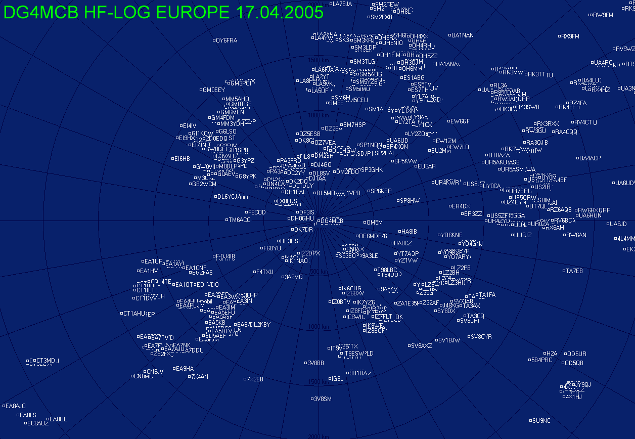
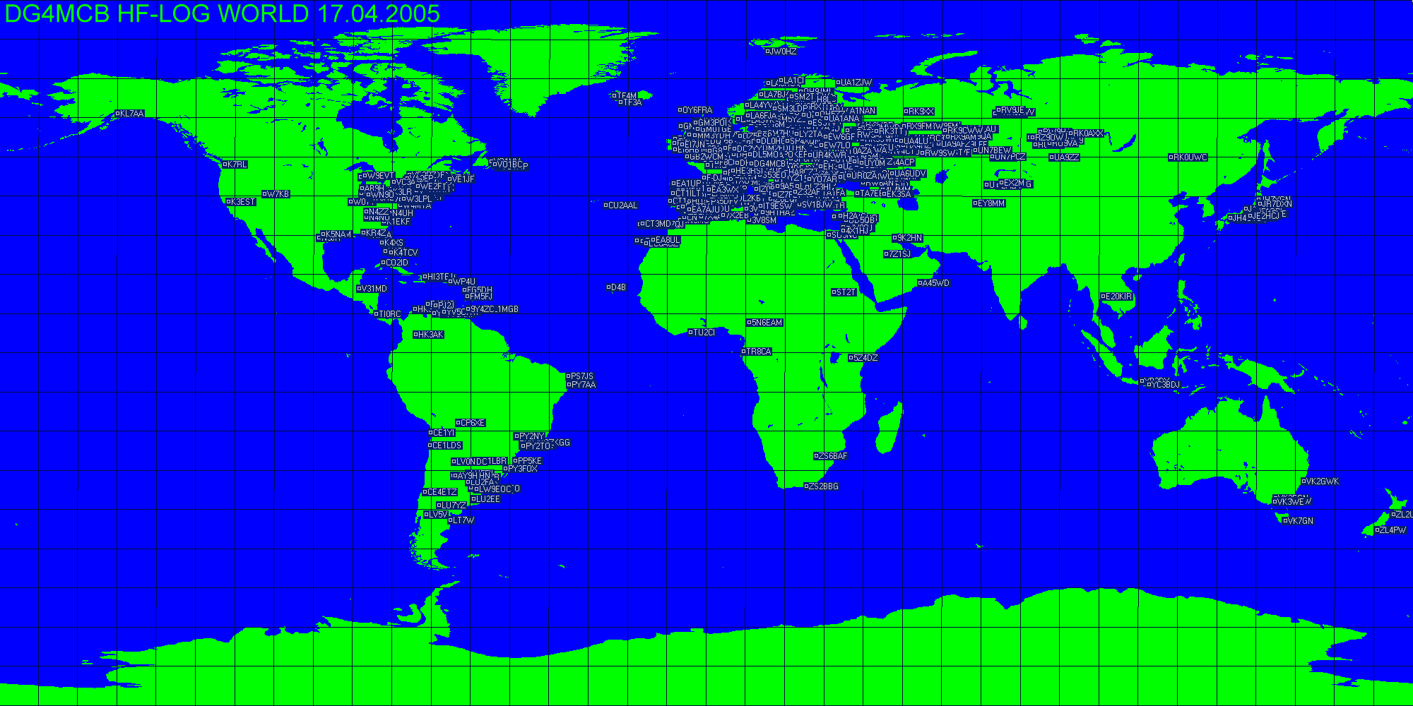
QTH Locator V0.47, Example: distance and angle display
QTH Locator V0.47, Example: map display
mailto:dg4mcb@darc.de
feedback
form
DG4MCB
FORUM
Local Time:
Amateur Radio Pages
Deutscher Amateur Radio Club,
Ortsverband
Pfaffenhofen C22
Deutscher Amateur Radio Club
QRZ.COM
DX Cluster
Amateur Radio
Stations heard via ISS
Amateur Radio Stations
heard via PCSat
NCDXF/IARU
Beacon Transmission Schedule
my
own NCDXF/IARU beacon observation project
my QRZ.COM data
Space Weather / Propagation Information
Near Real Time
MUF
Map
Solar Zenith Angles
Height Max of F2 Layer
F2 Layer Critical
Frequency
Map
E Layer Critical
Frequency
Map
Propagation
(Funkwetter)
Solar Terrestrial Activity Report
Solar Wind Data
HF - Propagation
Predictions
from the United Kingdom
Cuurent Raw LASCO EIT
Image
Astronomy / Satellites
Heavens Above
Astronomy
Picture of the Day Archive
http://www.celestrak.com/NORAD/elements/
(actual satellite data, for WINORB or HOMEPLANET)
others
Was ist Amateurfunk
?
Ist Amateurfunk schädlich
?
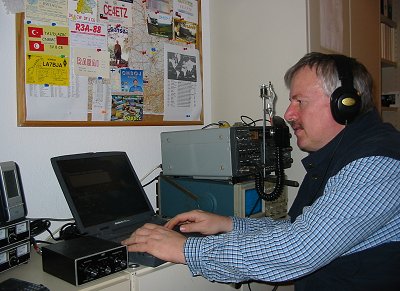
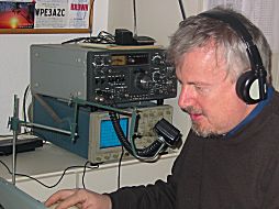
(DG4MCB
during WW DX contest 2005)
Impressum:
German Amateur Radio
Station
DG4MCB
OP: Josef (Sepp) Neulinger
QTH: Freisinger Str. 4a
D-85238 Petershausen
Germany
e-Mail: dg4mcb@darc.de